Tag: Off-Road

Diablo Dropoff

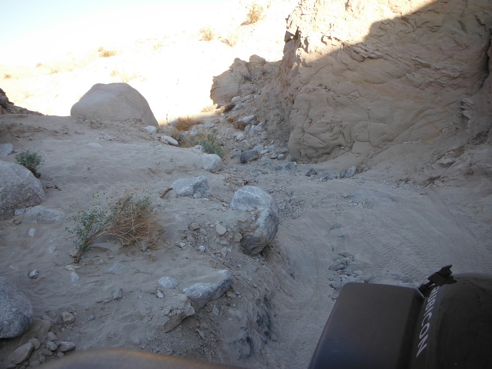
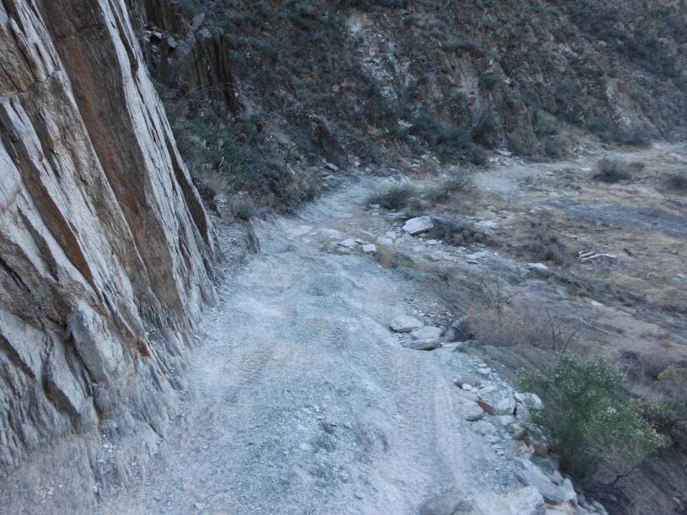
Diablo Dropoff is surrounded by a network of trails in Anza-Borrego Desert State Park. How hard this obstacle/trail is depends greatly upon weather conditions and seismic activity. The first time I went through Diablo Dropoff in 2012, the dropoff was heavily eroded and rutted.This gradually got worse until the dropoff was impassable due to part of the trail collapsing. Sometime later, the trail was restored and the dropoff was pretty mild. As always, the trail is gradually degrading and becoming more interesting to drive through. After going down the dropoff, there a few rocky washes and the trail gets easy again. A good stock 4×4 with some ground clearance should be able to make it through the trail.

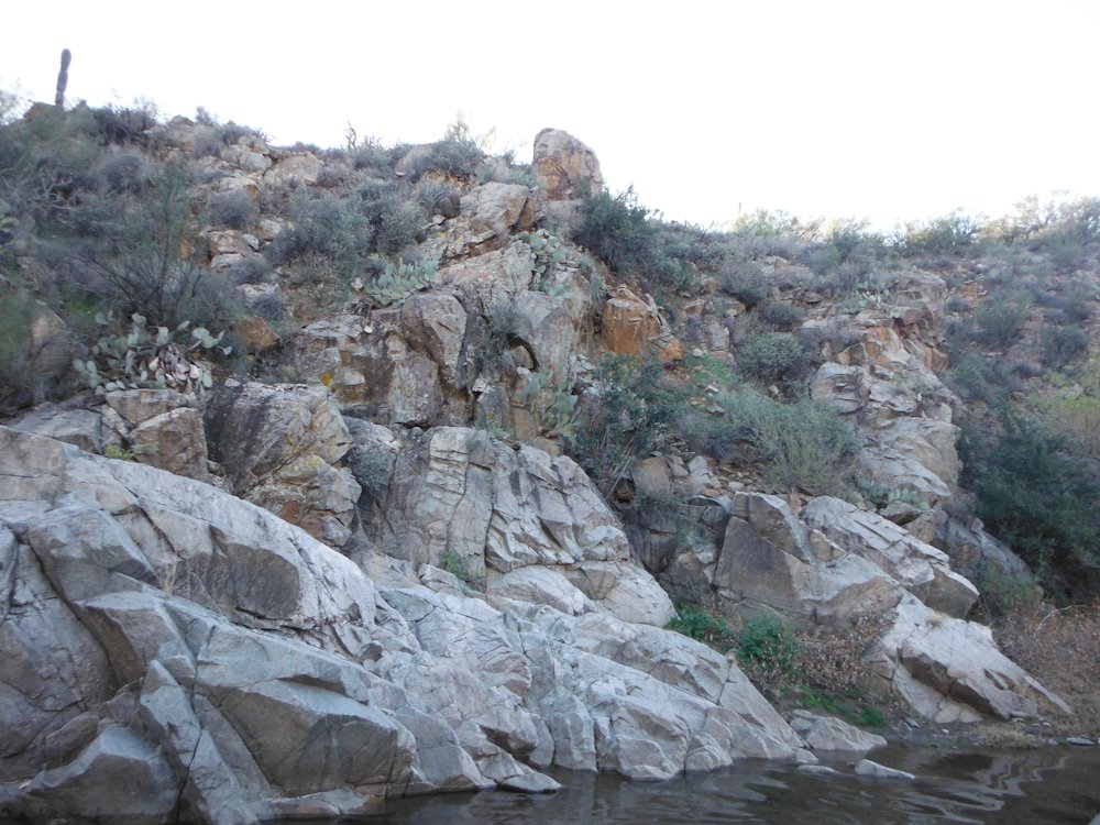
Even without the trail being difficult though, the views are spectacular and worth taking a look at even if you don’t drive all the way through. Since their is a lot of seismic activity in the area, don’t spend to much time in the mud caves or under overhangs. Rainstorms can also cause the cliffs to collapse. From the southern end, this trail can be reached by taking S-2, exiting onto Canyon Sin Nombre, heading north and turning right onto Arroyo Seco Del Diablo after about five miles, then turning right after seeing the sign for Diablo Dropoff after about six miles. There are other ways of reaching this trail, which I will happily type up about in due time or for anyone who asks. Here are some of the pictures and look on this page for the rest of them. Enjoy!

DSCF2621 DSCF2637 DSCF2652 DSCF2631

Turkey Creek

This is yet another trail in Arizona, which is a nice, moderate, and rocky trail. There is one narrow slot that will be harder on wide trucks. You’ll pass through Turkey Creek several times, pass a mining operation, and see some cattle along the way. This trail also has some old ruins, plenty of interesting flora, and awesome rock formations. The north end of this trail hits a little town called Cleator. Not many people live there, but there is a bar and a few cabins for rent. The whole area is pretty cool in general. This trail can be reached from it’s southern end by taking exit 248 off I-17, heading north along Crown King Road, and staying to the left when the road branches toward Mayer. I reached this trail from Black Canyon Creek and there are also many ways to reach it from the north end. Enjoy the photos! Look on this page for the rest of them.

DSCF4149 DSCF4174 DSCF4167

Black Canyon Creek

These photos are from a trail in Arizona that’s north of Phoenix on the west side of I-17. This trail is rocky, steep, difficult, and should only be accomplished by an experienced driver. Short-wheelbase vehicles will have an advantage in this terrain. Mistakes can easily lead to rollovers on the more tippy spots. This trail is also a lot of fun, has beautiful scenery, and is one of the better trails I’ve been on. I used I-17 to reach the general area, then took Exit 244, headed north, then west on the trail from Maggie Mine Road, and turned right at the Y-intersection. Just understand that there are several ways to reach this trail. The left turn is meant for an ATV or side-by-side. If you pass a mining claim don’t steal from it, just enjoy the scenery. I hope that you like the photos, click here to look at all of them.

DSCF4102 DSCF4134DSCF4126DSCF4130

El Camino Del Diablo

This trail is another trail that you would take more for the scenery rather than the difficulty. While this trail does have some extremely dusty spots and a few rocks it’s a relatively easy trail to pass through. There are lots of old ruins, lots of beautiful cacti, and plenty of interesting geological formations to stand in awe of. Much of this trail is only a few miles north of the Mexican border and also runs along the Barry M. Goldwater Range. Do not enter the live fire range. A permit is required to pass through the trail which can be received at the Marine Corps Air Station, Yuma on the west side or Cabeza Prieta N.W.R. in Ajo on the east side. Look here for more information on the Cabeza Prieta National Wildlife Refuge. I took I-8E, got off at exit 14, took S. Frontage Road east until I turned south on South Ave. 15 East which then turned into a dirt road that wound through the La Fortuna Mine to reach this trail.

You’ll find a large number of water stations and emergency beacons along the trail, though during my time through I didn’t pass any illegal aliens. This trail is also frequently patrolled and there is a Border Patrol station near the east end. Enjoy the photos, click here to take a look at all of them.

DSCF4049 DSCF4058 DSCF4093  DSCF4028

Font’s Point

Font’s Point isn’t reached by any hardcore trails, but is still quite a beautiful sight to behold. Font’s Point is east of Borrego Springs, CA and can be reached by S-22 and then taking a graded sand road a few miles south. It doesn’t take much of a vehicle to reach Font’s Point, just a little momentum and ground clearance will get anything through to the breathtaking views available. I hope that you enjoy all of the photos! You’ll find more on this page.

Introducing my new 4×4 picture gallery

One of the things that I greatly enjoy is going off-road and hitting the trail in my Jeep. I’ve taken numerous photos and fully intend to take many more. I’ll be posting up shots of my own Jeep, various other trucks and 4×4’s that I see along the trail, and the various trails that I have and will see. Maybe you’ll find some photos that you like or perhaps you’ll even purchase your own truck or 4×4 if you don’t have one. Either way, below are some sample pictures and you can see the Picture Gallery page at the top of the menu bar. Enjoy!

DSCF4481 DSCF5396 DSCF2917