Tag: Tacoma

Bear Valley Road (16S12)

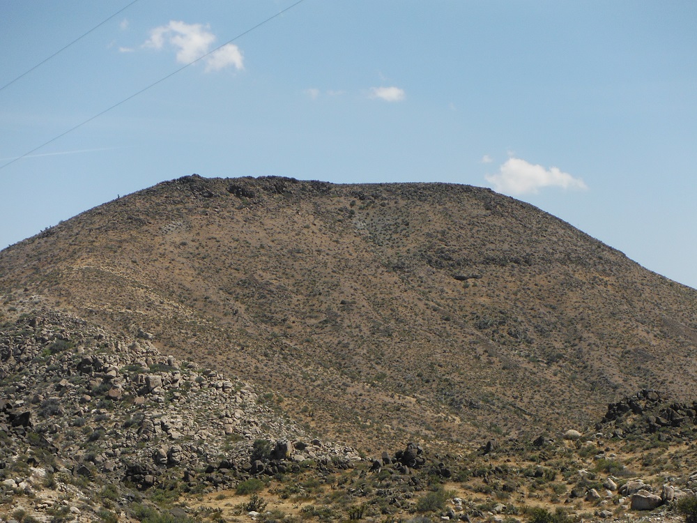
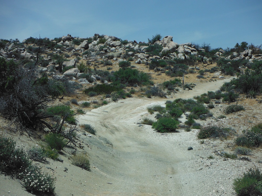
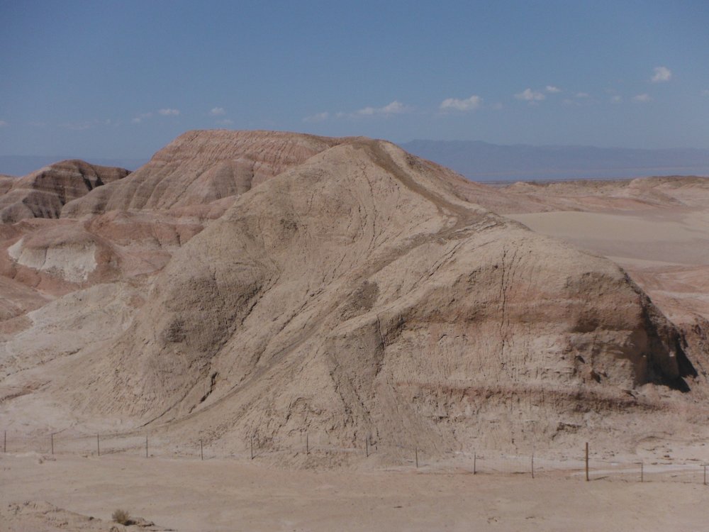
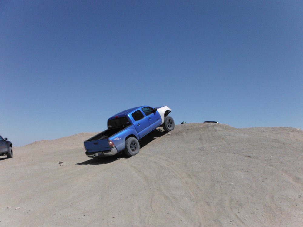
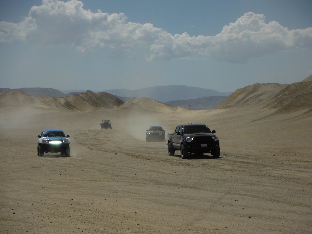
Bear Valley Road is an easy trail located about 40 miles east of San Diego that is accessible directly from I-8. With dry conditions any 2WD truck with some ground clearance can easily pass through this trail. There are numerous trails that connect to Bear Valley Road but the only other one that the public can routinely access is Long Valley Road (16S15) which I am also including on this page. This trail is great fun if you don’t feel like driving too far away from San Diego and want to avoid getting a full blast of the desert heat during the summer. During the Winter and Spring months the trail will be closed right before and during storms. Unlike many of the trails that I have gone through I went with a rather large group. Enjoy the photos and videos and look for the rest of them here on the dedicated page!

Cleveland National Forest website

White Mountain

White Mountain is a trail of moderate difficulty that a 4×4 truck with decent tires should be able to navigate. No obstacle is terribly difficult but there are lots of tough rocks of which a few demand careful tire placement. For much of the trail the brush is very tight or there is a steep cliff to one (or both sides) which may make it very fun to deal with opposing traffic. It would be wise to stop your vehicle at an open spot when you get a chance and take a quick look to see if any other trucks are heading your way. For this trip I was a passenger (for once) and just got to enjoy the scenery a little more than I usually do. I also had a great chance to take more photos than normal, enjoy the rest of the photos and videos here on the complete page!

White Mountain location:

white_mountain

Clark’s Summit and Skyline Drive

I’m putting both of these trails on the same page due to how they intertwine with each other. I suppose you could just drive along Skyline Drive on its own but only completing Clark’s Grade would require a U-turn as soon as you reached the top. A 4×4 truck with decent ground clearance and tires will easily pass through this road under dry conditions. The path to Clark’s Summit is a narrow shelf road in which encountering opposing traffic is rather miserable. I’ve generally completed this route from the southern end starting at Seven Oaks Road just north of CA-38.

Upon reaching Clark’s Summit Skyline Drive goes off both east and west and snakes its way north towards a few different spots in Big Bear Lake. The views the entire way are amazing and well worth your time! There are many hiking and biking trails that pass through Skyline Drive so be sure to watch out for pedestrians. There are multiple methods of reaching both of these trails and I will have to pass through more of them in the future. Be sure to look on the dedicated page to find all of the photos and videos and enjoy!

Recovering a broken Tacoma

I was driving through EC 193 and then turned onto Fish Creek east in Anza-Borrego Desert State Park and passed by a couple of Tacoma owners. I decided to stop when I saw that one of them was having some major problems. Once I got close to it I could see that he had broken the bead on the right-front tire and snapped his passenger side tie-rod. He was going approximately 40 MPH through the wash when he swerved to miss some oncoming trucks and hit an embankment. We did what we could to keep the tire from moving freely but we had no solid object to pin it with. It was a long and slow 12 miles to a solid trail where the help he called from San Diego could take care of him.

Approximately where I found the broken Taco at:

EC 193 close     EC 193

I dropped the broken Taco off at the juction of the railroad and EC 193:

trestle

The repetitive slapping sound you hear at some points of the video is the right-front tire hitting the cab and frame. No matter though, 401 ft-lbs was able to drag the broken Tacoma through mud. It just took some gentle tugs.

Gold Valley and Gold Lake

The Gold Valley area can be reached from the north by taking CA-89 (Graeagle is the closest town of any significance) and heading west towards Graeagle-Johnsville Road. From the south CA-49 can be used to reach Gold Lake Highway. From the Guide to Northern California Backroads and 4-Wheel Drive Trails by Charles A. Wells (Mr. Wells has since converted his separate California books into a single book):

From Auburn and Grass Valley, take Hwy. 49 north and east past Downieville and on to tiny Bassetts. From Truckee, take Hwy. 89 north to 49 then go west to Bassetts. From Bassetts Station, take Gold Lake Highway west then north about a mile and a half. Turn left over a bridge following signs to Sardine Lake. After 0.2 miles turn right towards Packer Lake. Go another 2.7 miles and turn left. Climb uphill until you reach Packer Saddle at the top of a ridge in another 1.6 miles. You’ll continue straight on a gravel road for Gold Valley Trail. Deer Lake Trail is to the right and Sierra Buttes Lookout is left on the paved road.

The area around Gold Valley (and the Tahoe National Forest in general) is simply astounding. I went here last September so there were no snow problems but obviously that’s a different case during the winter and early spring months. The trail happens to overlap with the Pacific Crest Trail in some spots so be sure to watch out for hikers and cyclists. As always, be sure to share these photos and videos with your friends. Enjoy!

Location of a campground by Gold Lake:

Gold_Lake_1    Gold_Lake_2

There are many more videos and photos of the area on the trail-specific page.

DSCF6157    DSCF6169    DSCF6172    DSCF6183


DSCF6193    DSCF6213    DSCF6188    DSCF6217

Fish Creek

I’ve documented an off-road jaunt through the Diablo Dropoff and Fish Creek already but this time I got more video. I started this trail about an hour before sunset so I actually have some video going all the way to the Wind Caves now. The first mile and a half after the Diablo Dropoff is tight and rocky with everything after that being pretty tame. Enjoy the videos!

fishpoint

Table Mountain

The Table Mountain area doesn’t have any hardcore rock-crawling. As long as your truck has decent ground clearance and you can pick a good line you will make it through the area. My nearly stock Tacoma made it through. A locking rear differential or a little lift in the front would have helped out greatly though. The Table Mountain network of trails in of themselves don’t extend to other roads unless you count some footpaths. The network of trails lead to some amazing views, though it can be hard to tell if you’re on a legitimate trail or not. A lot of the paths in the area are closed but aren’t  marked very well.   There’s not really any way to get lost in the Table Mountain area, just drive back the way you came once you hit a dead end or random fork with a camping spot. The trail was pretty empty the day I went, the only vehicle I passed was a first-generation Tundra. No one on dirt bikes or ATV’s to get into close calls with here.

To reach the Table Mountain area: drive along I-8 and exit at the In-Ko-Pah Road exit, head west along U.S.-80 and turn right onto a dirt road near the brake-check station. Enjoy the photos and find the rest of them here!

DSCF6007 DSCF6006 DSCF5943 DSCF5931 DSCF5934

The Gas Dome

I went through a series of trails in the Ocotillo Wells State Vehicular Recreation Area (SVRA) this last Saturday with some other Tacoma owners. The Ocotillo Wells SVRA is just west of the Salton Sea and is easily accessible by either CA-78, CA-86, or S-22. There are towering sand dunes, numerous geological formations, easy trails, hard trails, and a lot of open space to either methodically crawl or quickly speed through. We passed through the Shell Reef Expressway, Pole Line Road, and the Gas Dome among other places. I’ll post up about other trails soon, but for this one I’ll have mostly just photos from the Gas Dome up.

There are many graded gravel roads that can be used to reach the Gas Dome, just as many more difficult routes may be taken. The Gas Dome is one of the few areas of the Ocotillo Wells SVRA that is partially blocked off to prevent damage to the features of the area. The Gas Dome is near Pole Line Road and trail signs are abundant, so it is relatively easy to find. The Ranger Station has many maps of the Ocotillo Wells SVRA and is a good first place to check out if you’ve never been to the area. Enough of my babbling though, here’s a link to the photos with a few teasers posted below. Enjoy!

DSCF5855 DSCF5860 DSCF5862

A fine explanation for what is happening in the surrounding area.

Bonus pictures! Here are some of the other trucks that I went out with.

DSCF5836 DSCF5866 DSCF5848